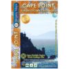
This is map three in our three-map series of Table Mountain National Park. Waterproof and tear resistant in plastic sleeve.
This brand new, fully redrawn and highly detailed map shows all approved paths and includes full GPS information for this historically-fascinating hiking area. The double-sided map with Cape Point on one side and Simon’s Town (including Kommetjie, Glencairn, Fish Hoek and Kalk Bay) on the reverse also highlights the Hoerikwaggo Trail.
The Cape Point side includes the whole Cape Point Nature Reserve: the area south of Miller’s Point and Klaasjagers all the way to Cape Point and the Cape of Good Hope.
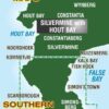
The Simon’s Town side covers the area from Kommetjie to Fish Hoek/Kalk Bay and south to Glencairn, Simon’s Town and Miller’s Point, and west to Red Hill, Scarborough and Witsand.
The Simon’s Town side covers the area from Kommetjie to Fish Hoek/Kalk Bay and south to Glencairn, Simon’s Town and Miller’s Point, and west to Red Hill, Scarborough and Witsand.
Cape Point and the southern half of the Cape Peninsula and the Table Mountain National Park including Si- mon’s Town, on a double-sided, contoured, GPS compatible map at 1:20,000 with hiking trails and a wealth of other tourist information.
The map has contours at 5m intervals, enhanced by additional colouring for woodlands and sandy areas, with numerous spot heights and names of various topographic features.
Boundaries of nature protective areas and restricted entry zones are clearly marked.
Road network indicates private roads with or without public access, signposts, parking areas, etc. Hiking trails are annotated with distances and walking times, and show approved or not recommended sections. Extensive overprint highlights numerous facilities and places of interest including drinking water points, viewpoints, sport and recreational sites, best animal watching places, campsites and other tourist accommo- dation, restaurants, etc.
The map has numerous GPS waypoints for road junctions and other important locations, plus UTM grid lines at 200m intervals and latitude/longitude lines at 1’ intervals.
The map is illustrated by colour photos of local fauna and flora and has additional notes with tips for visitors.

| Weight | 90.00 g |
| Dimensions | 23 × 16.5 × 1 cm |
| ISBN | 978-1-920377-42-7 |
| Countries | South Africa |
| Product Type | Folded Waterproof Hiking Map |
| Scale | 1:20,000 |
| Printing, Size & Binding | A1 |
| Location | Western Cape, South Africa |
| Ediiton | 5 |
| Publication Date | 2021 |